

Consultation
in Context
A web-based geographic information system used to host project data, collect consultation data, review permit and land status, track construction progress, and inform project decisions.
Developed by industry experts for use in the field.

Consultation
in Context
A web-based geographic information system used to host project data, collect consultation and negotiation metrics, track progress, and inform project decisions.
Developed by industry experts for use in the field.

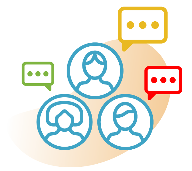
Let the community speak
Mapbase provides confidence in the consultation process. Allowing you to communicate complex information effectively and partner with communities in project success. The community is the access to an effective project process and can be a costly endeavor. With Mapbase you can accelerate this process confidently and cost-effectively.

Understand access on the ground.
Mapbase provides confidence in the right of way process allowing you to view complex permit and land information and effectively partner with project contributors from development through to construction. Understanding right of way access is key to an effective project, with Mapbase you can efficiently and confidently communicate the project status with all stakeholders.
Get the full picture.
Mapbase converges spatial information and data so you can draw informed conclusions from a holistic point of view to manage complex infrastructure projects and communicate information easily and accessibly.
Talk to one of our experts.
We’ll show you how Mapbase can amplify your consultation process.

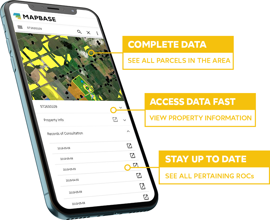
A mobile-optimized single point of truth.
Mapbase is designed to access information quickly and consistently across large teams and integrate with your existing platforms. Store key project documents, shapefiles, reports, agreements, and access project data in the field—when it matters most.
Access Data. When it matters.
Stay focused on your project goals
Infrastructure projects are complex and have many moving parts. With Mapbase you can manage all the aspects of the project and milestones and ensure that each team member is supported and empowered to meet their milestones on time and on budget.
Resolve issues quickly and efficiently as they arise.
Don’t wait for issues to become barriers. Efficient day-day communication and information sharing is vital to achieving milestones on time and on budget. Stay up to date on stakeholder negotiations and acquisitions, permit and crossings status, or other project-related deliverables on any web or mobile device. Speed of access and delivery is crucial to effective project, stakeholder and community management.
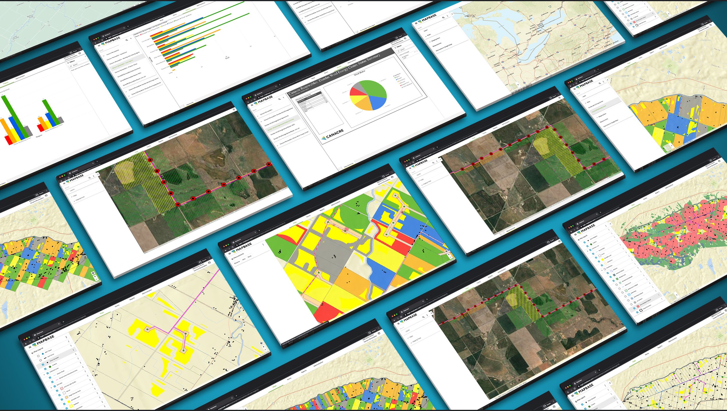
Loaded with features to amplify your process.
Interactive Project Maps
Navigate a project footprint and review property, consultation, and status details.
Measure, navigate, and select features which impact project decisions.
Draw, sketch and view features on the map to assist in communicating issues on the ground
Real-Time Report Generation
Customizable reporting templates and outputs allow users to view and orientate information from a fully dynamic database.
Download spatial layers as a Google Earth KMZ, Shapefile or Layer Package.
Report on ROW status, land access, permitting, consultation, issues and progress velocity project or portfolio wide.
Advanced Search Abilities
Find spatial, tabular, or consultation information all in one search.
Filter to data most important to your project or decision.
Drive down to attributes in a specific layer, and automatically be prompted of recent criteria
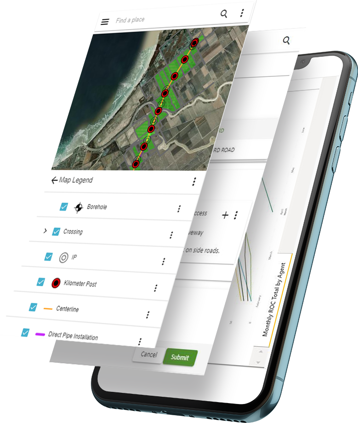
Mobile Driven
Take Mapbase with you in the field and monitor your location in the mapping interface.
Access important property, status or consultation data prior to meeting with a stakeholder.
Portfolio Reporting
Report on a portfolio of projects and aggregate your data to a single point of truth.
Use the PowerBI functionality to reporting mileage, MW, or sites.
Data Input Forms
Fully interactive Data Input Forms prompt users and increase the accurate of data inputted.
Create new forms based on the needs of the project and standard practices of your organization.
Customized Access Permissions
Control how users see and interact with project information.
Limit a project teams scope to mapping while another generates rich reporting deliverables.
Document Upload
Upload documents via Forms to spatial features and access through the fully interactive map.
Track one to one or one to many relationships through the use of interactive Forms.
Let’s talk about your project goals.
Book a demo to see how Mapbase can help you take the pain out of consultation and gain social license cost-effectively and consistently.
(800) 645-0093 info@canacre.com